
ALTA Survey & Land Development
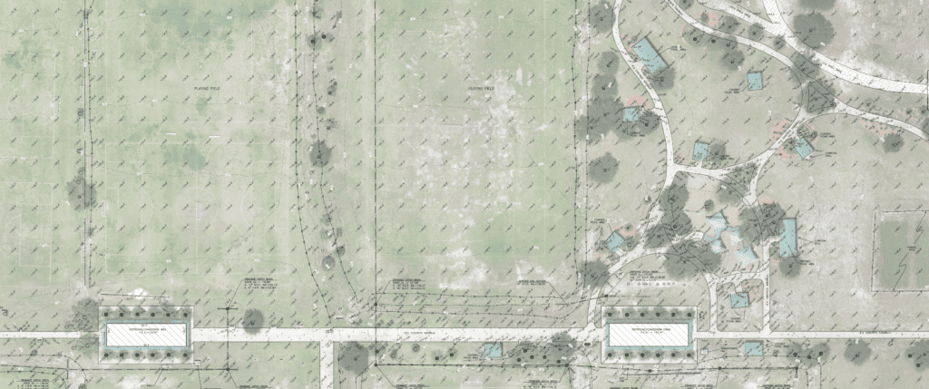
BPI offers comprehensive ALTA Survey and land development services, including precise boundary assessments and topographic and hydrographic surveys. Our expertise extends to providing full scope services that encompass detailed contour mapping and analysis. By employing advanced techniques and cutting-edge technology, BPI accurately defines land development boundaries, enabling clients to make informed decisions about their projects. Our topographic surveys capture the intricate details of the terrain, providing valuable information about elevation changes and natural features. Our land development services include full scope of services for our clients projects from boundary establishment to easements, survey plats, topographic surveys with contours, generating tin surface files, and more. These combined services ensure a thorough understanding of the land and water environments, facilitating successful and sustainable development initiatives.
ALTA Title Surveys & Boundary / Topographic Surveys
At BPI, we excel in offering ALTA Survey and large boundary and topographic surveys that are rich in detail and cater to the specific needs of engineering design projects. Our surveys go beyond simple measurements, encompassing intricate elements such as contours, surface models, and bathymetric data. By meticulously capturing and analyzing these features, we provide a comprehensive understanding of the terrain, enabling engineers to make informed decisions about their designs, ensure proper site integration, and ultimately enhance project outcomes. Learn more about ALTA Surveys and why you need them in Florida with this great article by ASR Law Firm.
Aerial Mapping
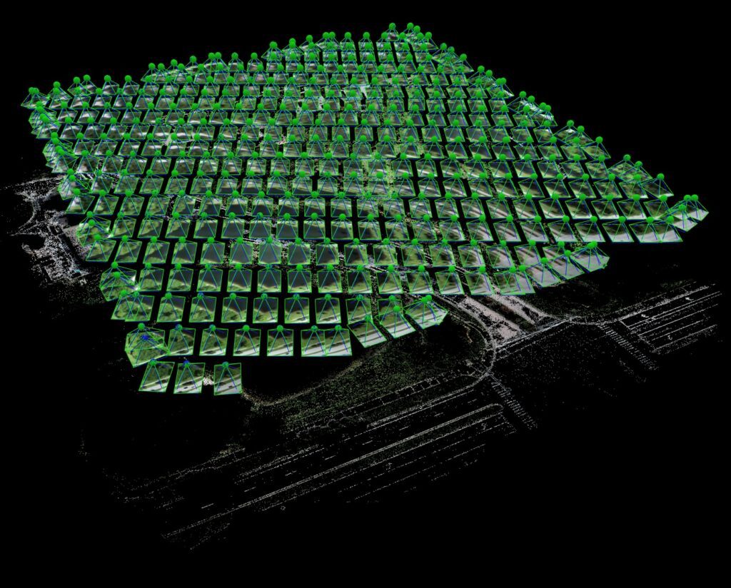
We utilize LiDAR and photogrammetry for precise aerial mapping services. LiDAR captures detailed elevation data using laser pulses, while photogrammetry analyzes aerial photographs to create accurate maps. This combination enables BPI to provide comprehensive and reliable mapping solutions for various applications. Upon request and for certain ALTA Survey projects, we will include aerial photogrammetry to support our traditional surveying methods.
- Urban Planning & Development
- Environmental Monitoring
- Construction Planning
- Collection of Pre-Engineering Design Data
- Emergency Response Monitoring
- Materials Volume Monitoring & Reports
- & More
Subdivision Plats
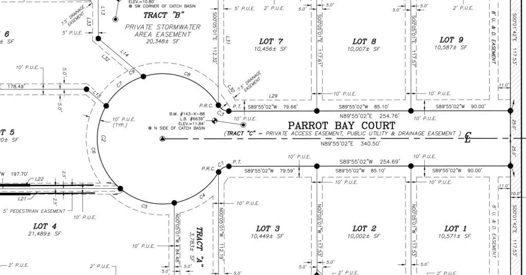
We offer subdivision plats as part of our services. Our team specializes in creating precise and comprehensive subdivision plats, providing clients with accurate representations of land divisions. Whether it’s for residential, commercial, or industrial purposes, our subdivision plats assist in delineating property boundaries, ensuring legal compliance, and facilitating organized land development.
Contact Us to Learn More
At BPI Surveying, we prioritize fast turnarounds, delivering detailed and thorough surveys, all while providing exceptional client support throughout the surveying process. Let’s have a chat about how we can help on your project today.